Canal Covered Bridge
Canal Covered Bridge, built in 1917 is 37.6 metres long. This bridge sits on a very quiet stretch of road with a very picturesque view from all around it. It is very close to St. George.

My Thoughts and musings.

Canal Covered Bridge, built in 1917 is 37.6 metres long. This bridge sits on a very quiet stretch of road with a very picturesque view from all around it. It is very close to St. George.
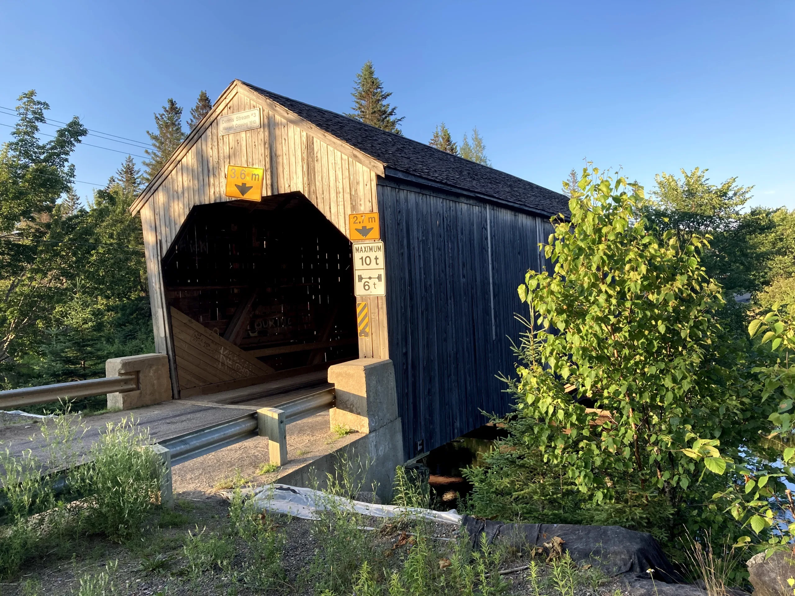
Dennis Stream #3, built in 1910 is 18.3 metres long. This bridge is right next to a railroad intersection, just outside Saint Stephen.

Magaguadavic River #7, built in 1905 is 18.3 metres long. This bridge is very easy to get to even though it is in a very remote area. It is down in a little valley and the river is an incredible view.
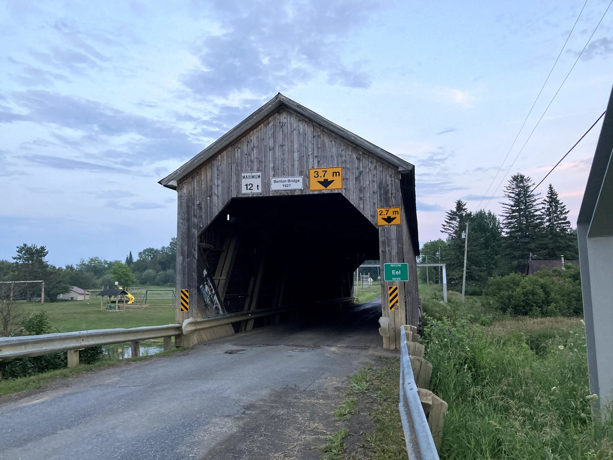
Eel River #3 from 1927 is 31.9 metres long. This bridge has a park next to it and the Eel River at this bridge is simply amazing. Not too far off the Trans-Canada, it is in a beautiful community undisturbed by the modern fast-paced way of life.

Hartland Covered Bridge, the longest covered bridge in the world at 391 metres long. It was built in 1901 but not covered until 1921. Which as in most bridges that I have seen so far are a wooden truss bridge and then look to have an attached independent shell to protect from weather or rot. Despite its fame for being very big, it is also the most tackey of every bridge in New Brunswick, from the big sign, string lights at the entrance, and the food truck lot next to the bridge, this made me urn for the other bridges I have seen across New Brunswick.

Florenceville Bridge, built at 16.9 metres long in 1907 is a partial cover bridge span. It is the cutest covered bridge crossing the Saint John River. It sits on a well-developed waterfront boardwalk that even trumps the water access in the bigger downstream cities of Fredericton and Saint John. Being located across the street from the McCain Foods headquarters there is a bench great for photos of the bridge at sunset with a carved potato. McCain Foods makes 90% of all french fries worldwide.
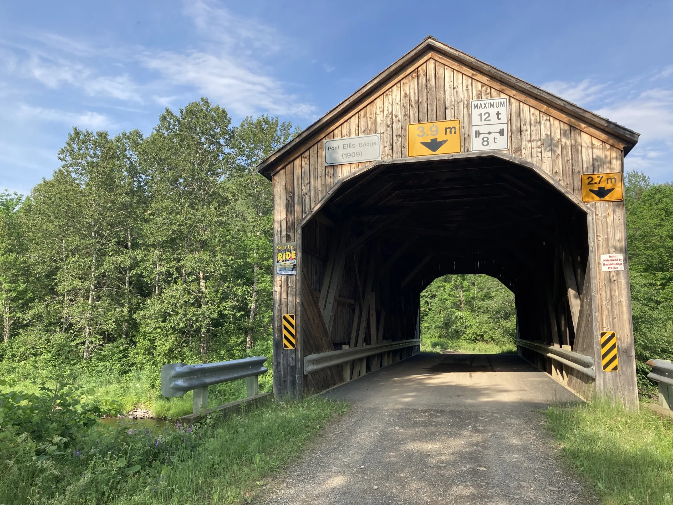
North Becaguimec River #4 was built in 1909 and is 18.3 metres long. This bridge is on a bit of a side road that is good until the bridge. The river at this point looks like an amazing fishing spot. This one is very easy to get to and very close to Hartland and Florenceville bridges.

This bridge is the Nackawic River #5 bridge from 1927 and 18.3 metres long. This is one of the more remote bridges and the road to get to it is eroded about 1km from the bridge but was passible with guidance and rocks placed over the ditch from the North Side. Accessing this bridge from the south by car is better, but you cannot take a normal car across the bridge due to road conditions. There is a heat shack neat by for the NB Trail users and this area is beyond beautiful there is a trail that goes along the river to get a great view of this bridge

This is the Cocagne River #5 Bridge. Built in 1913 it is 25.3 metres long. This bridge you must approach from the south. The north route is faster from the main road but as you turn on to this screen you are on the top of the ridge and get to see the most breathtaking view of the whole Cocagne River Valley and can see forever. Trust me just do it.
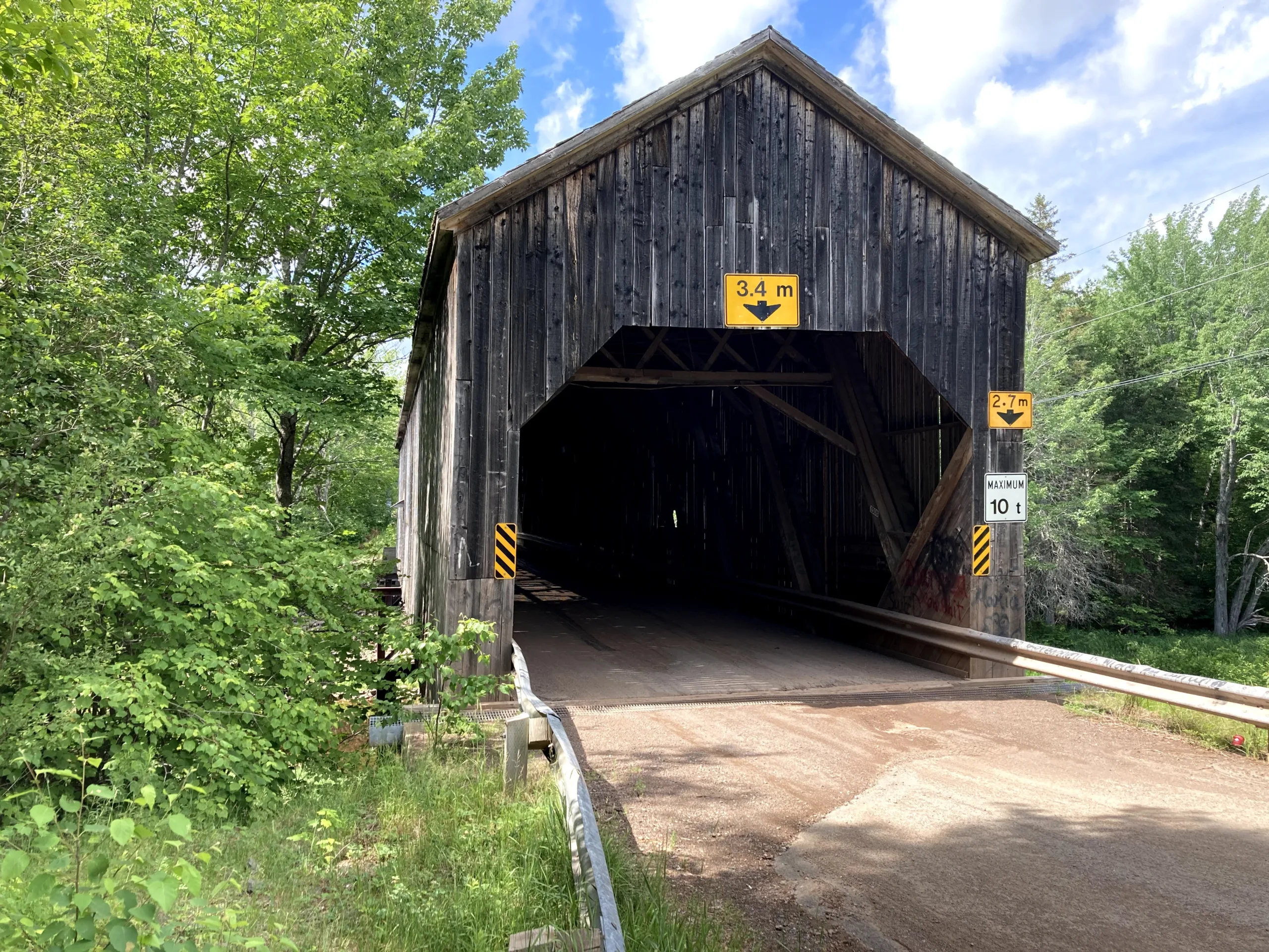
Cocagne River #3 Bridge built in 1942 is 41 metres long. This bridge is near Moncton and is semi-remote to get to. The road to it is not the greatest and I stopped a short walk away and walked to the bridge. It is a calm and quiet area and the Cocagne River is cute but not fast-moving like the area around it.

This 1935 Shediac River #4 Bridge is the 1st of my non-accessible bridge. It is on the NB Trails system just a short walk from the road. It is in a little valley that has an amazing little river passing through. This is a 25.6m long bridge.
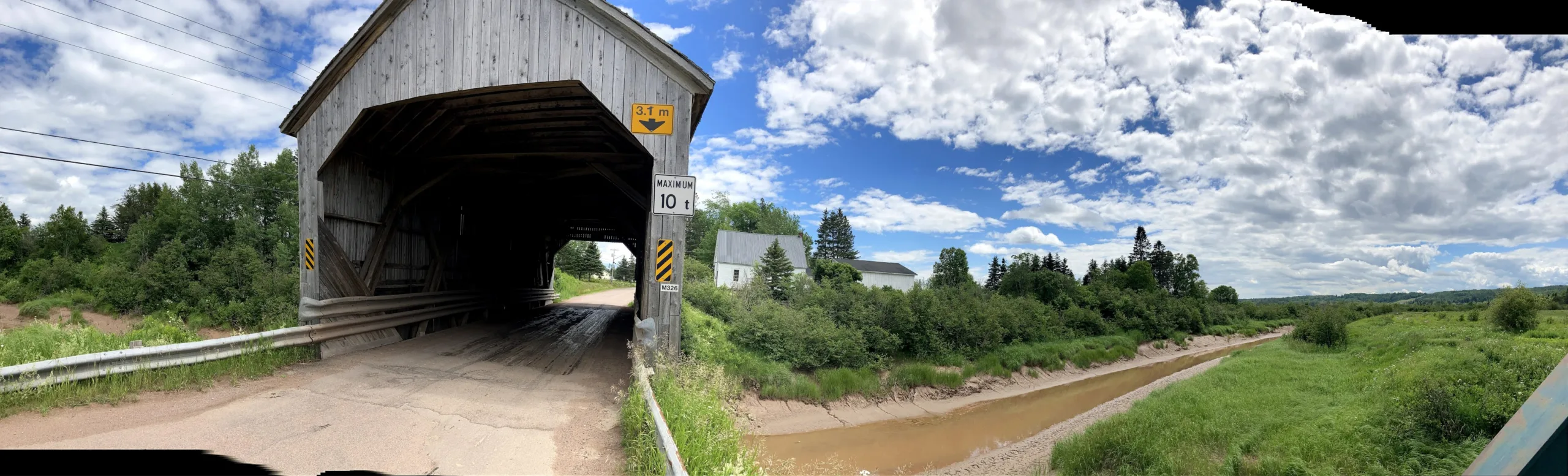
This is Memramcook River #4 bridge dating back to 1930. This bridge is 22.6m long. This one is not too far off the Trans-Canada highway and is really interesting and picturesque around the area.

Tantramar River #2 bridge is the furthest east covered bridge in New Brunswick. Built in 1916, this bridge is 49.7 metres long. This bridge can be seen for a long distance as it is the only structure in a far distance in every direction on the marsh and farmland in this part of the province.

Officially the Digdeguash River #6, this 1928 bridge is located in thein a very remote area. It is 23.2 metres long. At sunset the view was amazing, even took away from being eaten alive by mosquitos.
As we left off the quest, I was on the back roads of southern Ontario, with the Spotify music pumped. I was taking the back roads partly because it was taking everything to keep myself together, and partly because the 410, 407, and 401 scare the hell out of me. It was at this point, I decided that seeing Niagara Falls wasn’t going to happen with the gloomy dark cloud of depression. It was also raining and cloudy too. After close to 2 hours, I arrived in Kitchener and the sun came out there. I managed to find a convenient little parking spot and walked down Festival street. I have written before about Kitchener-Waterloo Oktoberfest but there is something about this festival that in its own special way brings it over the top. There seems to even be a much higher percentage of people in a traditional dress than you even see in Munich. The Rogers Hometown hockey was there and there was a beautiful smell in the air that brought nostalgia back. Like most things, however, the second time is just not the same and the depression came back. I grabbed a sausage and water and then went to…

Planning for this trip started months ago, it was planned as the best available excuse to visit Brampton Civic Hospital to determine what was real and what was not. I had already sacrificed a day from this mini-vacation for my day visiting the Anthem of the Seas and had Friday to Tuesday for a road trip to Brampton. “Coincidence” (with air quotes) would prevail that it was also during Kitchener-Waterloo Oktoberfest. As the weekend approached, I was starting to have second thoughts about this trip and a feeling that it was not the most financially planned decision to make. It was literally the Friday morning that I was going to go. The plan was Montreal on Friday, Brampton/Kitchener on Saturday, Niagara Falls on Sunday, back to Kitchener on Monday for the parade and then drive home. As I was leaving Saint John and just passing Spruce Lake. Out of nowhere, a sheet of drywall flew in the air just metres in front of me and luckily there was none beside me and I switched lanes to avoid disaster. As soon as that happened, I had this dreadful feeling that this trip was a mistake. I continued on anyway. I crossed…


I was off the Friday before Canada Day and had Physio and a call for the pre-op to fix my pinky finger. I came up with a plan to take a spontaneous road trip to Ottawa. My surgery is concerning the possible side effects. I was pretty devastated after the call with my anxiety. Since I was less than 500km from my oil change mileage I went to Kia and booked the appoint for this past week. I went home and cleared out everything from my car I didn’t need, grabbed my passport and wad of US cash and took off down the Hwy 1 towards the border. At the border I got through pretty quickly and had no issues. Having all the signs in a weird foreign system of measurement increased my anxiety. In Calais, I fueled up and headed down Route 9 to Bangor. I stopped for dinner at Dysart’s. It was a pretty good meatloaf. I then proceeded down Route 2 to Skowhegan where I needed to pee bad so I stopped at a gas station and it was there my fate turned. My GPS lost my route and I was lost. I kind of remember Route…