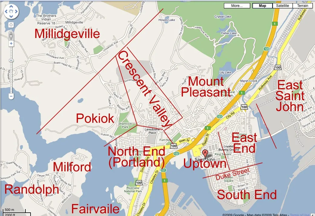
Today I picked up a copy of The Barron, UNB Saint John’s student-produced paper. I came across the article “Travelling around Saint John: what you need to know” by staff writer Simon Jack. It does not take long for one to realize the writer did not understand the history of Saint John or the Transit system.
The first point so I can move on was the reason he did not find information on the “Night Owl” run was that it was cancelled in Spring 2008.
Now to the areas of Saint John, to refer to drawing a random line to determine the limits of both Millidgeville and South End is vastly poor research. The boundary for Millidgeville dates back to the 1950’s era boundary of city limits. Basically, the official boundary is if a line was drawn from Somerset Street and Sandy Point Road westward to Pokiok Point that was the city limits pre-amalgamation in Saint John.
To define the South End one has to go much further back in time, back to 1785 (the beginning.) The Royal Charter that created Saint John defined the 4 wards of the “South Central” peninsula was split into quarters at Duke and Sydney Streets. The upper class mostly lived in the west side of the harbour, or northern two central wards. The poor (very broke poor) lived to the southern wards of Duke Street making the “South End” boundary Duke Street. Through the next 20-30 years, the South-enders made money suing the rich for literally everything. Leading to the creation of New Brunswick’s first Law School, which lead to UNB’s School of Law, as there were not enough lawyers to handle the workload.
In conclusion, it also needs to be pointed out the reasoning for the layouts of the streets have much to do with them being planned before those areas were part of Saint John in many cases.